Outback Travel Map
Our Towns
National Parks

Discover the Darling River Run Locations
The Darling River Run Discovery Directory - Discover attractions and activities, camping locations, where to stay, eat & drink, supplies, services and more.


")


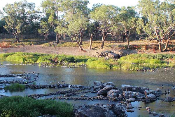
The Darling River Run
The Darling River Run is a thin, winding line describing a route through the NSW outback, characterised by landscape, history, culture, literature and adventure. Taken as a whole, or in its various component parts, the route provides an opportunity to see the real Australian Bush and experience some safe and easy off-road driving, connect with Aboriginal culture and iconic Towns & Locations along the Darling River, and drench yourself in the history, and contemporary life of a part of the country that is central to the national psyche.
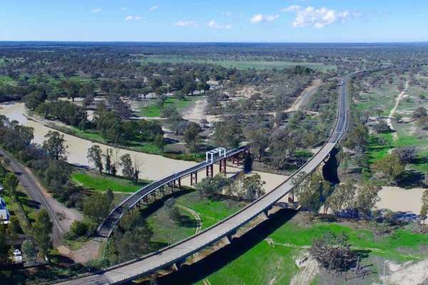
There are 23 rivers in the Darling River basin. The main two rivers are the Darling River and the Murray River, which is commonly known as the Murray - Darling River. The Darling River begins in southern Queensland, flowing into the Murray at the border of New South Wales and Victoria, with the Murray eventually reaching the sea.
If you are interested in learning more about the Darling River pop in to see the friendly staff at the Back O' Bourke Information & Exhibition Centre to purchase a two day pass to meander through our history. ... See MoreSee Less
Comment on Facebook
What does the 2 day pass give a visitor and how much does it cost, I am heading your way next week, currently in Gol Gol.
Interesting!
View more comments
Make the Menindee Visitor Information Centre your first point of call when visiting #Menindee.
Just look for the mural on the side wall of the building which shows an historical time line of the area. From the long history of the Barkindji people to the expeditions of Burke & Wills to the rich pastoral history of the early pioneers and the arrival of the steam train. The mural was painted in 2013 by noted artist Geoff DeMain.
The friendly volunteers at the Visitor Information Centre will provide you with all the helpful tips and information you need about the region and the Darling River Run. There is also a mini museum, art gallery and loads of great souvenirs for sale.
The Information Centre can be contacted on 08 8091 4274 and is located at 27 Yartla Street, Menindee NSW.
Central Darling Shire Council | Menindee Tourism #DarlingRiverRun #OutbackNSW #VisitNSW ... See MoreSee Less
Comment on Facebook
Do you know how to emu-late road safety when driving on country roads? Be aware that emus and other large wildlife can be fast and unpredictable.
For more information, visit Transport for NSW: www.transport.nsw.gov.au/roadsafety/road-users/drivers/animals ... See MoreSee Less
Comment on Facebook
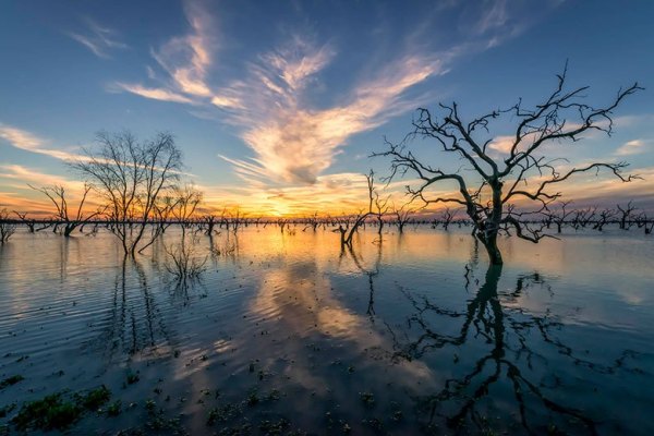
Great shot of the Darling-Baaka at night by Aaron Hawkins.Darling dreaming ✨
The Darling-Baaka river sets quite the scene. The ancient river which weaves through the landscape near home, with the ancient galactic core rising above. It was quite haunting to spend some time on the banks alone on Friday evening. Silence and darkness along with imposing river red gums definitely brought my senses to life. Thankful to have the opportunity to capture this simple scene. No fancy stuff here, shown as captured with no photoshop required.. The magic of the moment shining through.
📸 @nikonaustralia Z6ii and 14-30Z
And I wouldn’t have found my way into this remote spot without my @astro_night_au torch 🔦 ... See MoreSee Less
Comment on Facebook
Thank you so much for sharing! Was so nice to spend some silence on the banks <3
Amazing photo.
Great photo… but this was the best I could do with my phone 📱 😜❤️at Trilby Station
What a great shot
Spectacular photo mate .👍
Awesome photo
View more comments
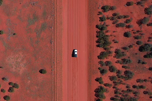
HAVE YOU SEEN THIS LANDMARK on the Darling River Run? Interesting how the road from above mirrors the shape of the Toorale plough sign! The sign is constructed from two tree forks and a plough, and is located at the entrance of the Toorale Homestead precinct at Toorale National Park near Bourke NSW.
Toorale Homestead precinct (Yarramarra) is open 7 days a week, 8am–5pm. Entry inside the homestead and outbuildings is by NPWS guided tours only during the school holidays. For further information call the NPWS Bourke office on (02) 6830 0200.
#NSWParks s e
📷 Andrew Drane | ne ... See MoreSee Less
Comment on Facebook
Yes, I have … many times 😎
The sign was made and erected by my brother, Richard Walker when he was manager of Toorale before it was taken over. He was there in the 1970's.
Toorale. Penny Wong bought it for $23m around 2009. It used to be a productive 10% of Bourke’s economy. The reason given was to remove the 100 year old banks that the settlers used to save water. So that the saved water could run in to the Darling river. I think the banks are still there?
Looks like a fork in the road to me, the fact that it resembles anything is just coincidence just like the other hundreds of intersections that look just like it.
We are planning to do this trip this year but I imagine it would be boggy and flooded at the moment with all the rain. When is the best month to do the trip?
My family lived on 'Toorale ' years ago....
Is it open in mid may and acceptable to vans how far out if Bourke?
Yes went out there last year, even found the cemetery. Did not realise that it was on the Darling River run.
Jess Whittick
Sure have
Work there a long time ago
Yes
Frank Burchell
Terrence Dale
Yep 😂
A big YEP
Similar to the forks in the tongues of those who stole water from that part of the Darling River system??
View more comments
Photos from Brewarrina Aboriginal Cultural Museum's post ... See MoreSee Less
Comment on Facebook